With a long over due desire and a recent change in weekend plans, we finally made it to the Brianhead/ Cedar Breaks area to ride the pedal bikes. We chose to camp up by Navajo Lake to stay close to trails and as a great in between spot nestled in the peaking aspens. Here's what we found.
One of the uncrowded overlooks at Cedar Breaks and a glimpse to the distant Blowhard trail by the small dot atop the distant peak (Blowhard mountain).
Yes, it is still Milkyway season and the wind finally let up enough to shoot a few exposures looking straight south towards Navajo Lake.
The landscape around the lake was reminiscent of Bend Oregon and the Mckenzie River sections with lava.
Lichen covered lava was only on the east end of the lake and made for a cool start to our loop up to the Virgin Rim trail.
Insert postcard title here " ". wish you were here! Looking south towards Zion National park.
Hard to tell just how windy it was, but that was as close to the edge as I felt confident with.
Although we did not ride the Blowhard trail together, I chose to hike up from the parking to get one shot of Amy descending the last fun narrow canyon section before the drive back.
Since we only rode the Blowhard trail on our last day, we thought a hot lap in Cedar City on the Boulder dash and Lava flow trails would be appropriate. Look at my wife slaying this section of Boulder Dash.
Both the drive there and back provided amazing displays of Gods craftsmanship in the sky.
Showing posts with label trails. Show all posts
Tuesday, October 2, 2018
Sunday, July 19, 2015
They call it "Timp".
Mt. Timpanogos is the iconic peak range most notable just east of the Provo section of I-15. It is part of "the Wasatch" range that lines the interstate from Ogden down to Spanish Fork and beyond. I recently decided to summit Timp after oogling it for over 3 years now. I have viewed and photographed it from all aspects imaginable including a couple of fly overs with the help of Delta airlines. Here is what I saw on my 15 mile loop 4800+ ft ascent to the summit (11,749 ft) of Mt. Timpanogos.
I chose the Aspen Grove trailhead instead of the Timpanooke trailhead as I hiked the latter last summer to Emerald Lake. You start out with a few of these cascades heading up Primrose Cirque.
Mid-way up the Cirque you start to see the Cascade Cirque nose which is where Emerald Lake sits at the base of.
You can't miss the "Jangus" shack as you pass Emerald lake, this is also the preferred lunch spot for most. The wild flowers really turn on just before reaching this area and hold on pretty steady until you head west to the saddle.
The summit shack is now only 1300+-ft higher then Emerald Lake, which means your over 70% of the way there! I am jumping ahead here just to give you the other perspective looking down 1300+- ft to emerald Lake.
Now you know I summit-ed, but it's just getting good.
As you make your way up to the saddle at an even 11,000 ft you'll notice that the flowers are saying good bye.
This is another point at which some hikers decide to have lunch, turn around or just rest for a while but it is the first time you see the Provo valley below.
I would bet millions have seen Timp from the valley floor below as they drive I-15 north and south, but this is the tipping point if you want to Summit.
Less then a mile from the summit this is where the trail gets real technical. This 78 year old gentleman (white hat) just made the summit, so it's time to put your big pants on and get up there!
Not quite there but another great perspective of the trail, saddle and valley floor now thousands of feet below you.
I gave up on heavy leather hiking boots years ago and would not do another 14er, 13er or big summit without my hokaoneone.com. These are the ultimate in traction, weight, performance and stability. Try running a 100 miler in your old leather hiking boots!
The last schlog is less then a mile from the saddle but it tends to get pretty breezy at times, so be prepared and have a wind/rain shell.
I guess some "artists" just have to let others know they made it too. I believe that is what the register is for?
The clouds were moving in at a rapid pace but I had to show the view looking east towards Deer Creek reservoir and the snow field that I decided to ascend through on my return trip.
Deciding at the last moment, I chose to take the south route along this ridge line down through the snow field and back to Emerald Lake. That is Spanish Fork on the upper right side.
Just past Emerald lake you get back into the "flowers for ever" zone and into your final descent to where this all started. This is pretty much a whole day off excursion and shouldn't be missed if you love long, scenic, strenuous hikes! Bring plenty of water, photograph along the way and don't miss the gym one second.Monday, February 23, 2015
Catching the corn before Winter returns.
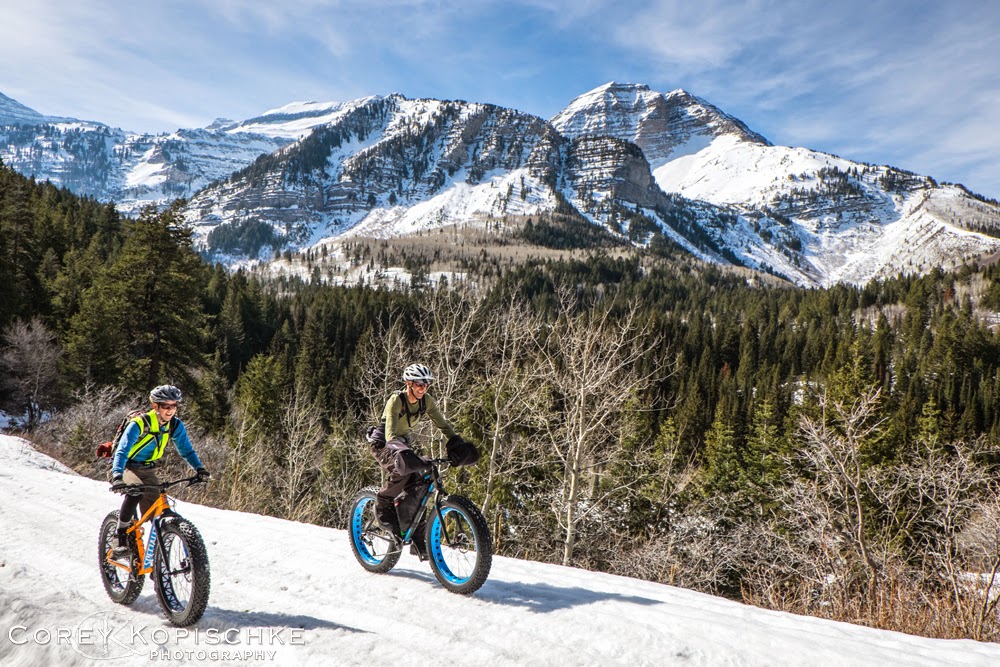
My brother recently visited from our old home of Steamboat Springs Colorado with a couple of over-sized grown up toys to play with in the spring like conditions of the Wasatch! Thanks to his wife for loaning her Specialized Fatboy to my wife, I then secured a Salsa Mukluk from the cool folks at Go-Ride sports. Conditions were mere guess work as this is a fairly new sport here and finding "daily ride" conditions is really hard. It only took about a mile of dry road before we got onto snow and even though we had a late start conditions were now great for the 4.7 inch tires with 6 psi.
The views are very impressive from the road, but we were hoping to find some firm corn which would allow for an almost endless choice of routes. Due to our late start, the higher we went the warmer the snow was feeling and the less our options became.
We stuck to the snowmobile tracks as these had the most stable base to keep us floating, but once we hit the highway summit we realized our tour was hitting it's return mode. The next day would change dramatically with lower temperatures and a lake effect[ storm.
Wow, what a day can do in the mountains! We actually made it to the summit of Guardsmen pass in the blizzard and decided the visibility was only getting worse, plus we were both ready to dry out,warm up and find some breakfast.
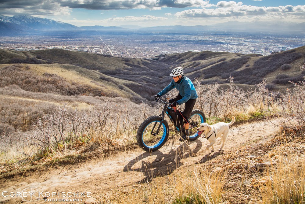
Meanwhile, back in the valley we had to get Blue out on at least one trail as the Wasatch canyons are all watersheds and do not allow dogs up any of them. The reliable Bonneville shoreline trail is always fun and even funnerer on a Fatty!
Subscribe to:
Posts (Atom)